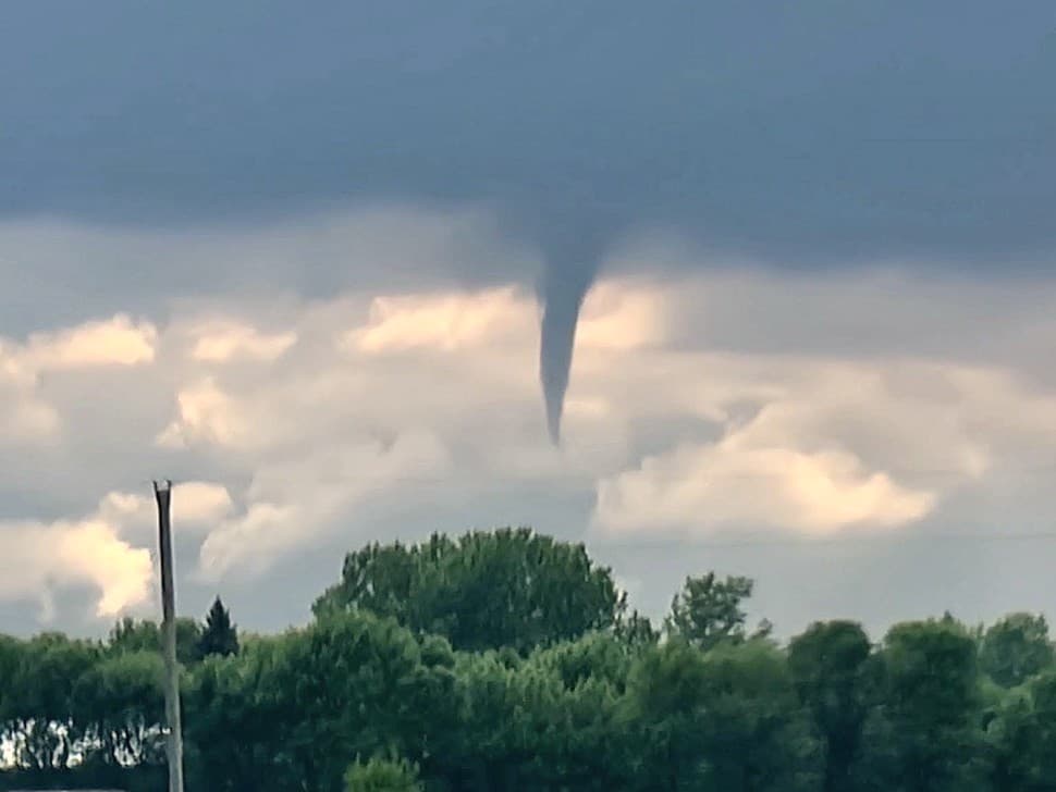
Wednesday produced a second straight night of severe weather in Southern Manitoba, with more funnel clouds reported in the southeast.
Environment Canada issued a Tornado Warning for several parts of the southeast Wednesday night, but there is no indication that anything materialized.
"We did receive some funnel cloud reports, but we don't have any confirmation of any touchdowns from last night," says Meteorologist Danielle Desjardins.
She notes they received funnel cloud reports from both Niverville and Lorette.
Related Stories:
- Tornado warnings put southeastern Manitoba residents on alert
- Severe weather brings heavy rain and funnel clouds to southeast Manitoba
- Tornado warnings continue Wednesday evening as storm rolls through
According to Desjardins, Environment Canada works in collaboration with the Northern Tornadoes Project, to confirm whether anything touches down. She notes they also value tips from the public. Anyone with photos of funnel clouds, tornadoes, or damage from Wednesday night's storm is asked to email them to their storm@ec.gc.ca account.
"That will help us determine whether or not there was indeed a touchdown or not," she adds.
In addition to two straight nights of tornado warnings, Wednesday was also the second consecutive evening of heavy rain. Manitoba Agriculture is reporting the following rain amounts for the Eastern region from Wednesday:
- Marchand - 41.3 millimetres (mm)
- Rosa - 37.4 mm
- St. Pierre - 31.2 mm
- Gardenton - 31.1 mm
- Dominion City - 26.5 mm
- Zhoda - 24.8 mm
- Richer - 24.5 mm
- Steinbach - 22.9 mm
- Vivian - 18.5 mm
- St. Adolphe - 18.4 mm
- Stead - 13.9 mm
- Dugald - 13.3 mm
- Lac du Bonnet - 10.6 mm
- St. Labre - 8.8 mm
- Menisino - 7.8 mm
- Beausejour - 7.7 mm
- Sprague Lake - 7.1 mm
- Prawda - 4.4 mm
- Elma - 3.1 mm
Desjardins says a slow-moving low-pressure system parked over the Prairies is what has been causing this unsettled weather the last couple of days. She notes the system is finally starting to track to the east.
"Two days ago, we had some severe thunderstorms over Southern Manitoba," says Desjardins. "Yesterday, again, the cold front associated with this low-pressure system tracked through the south, so that initiated some thunderstorms last night. But that system is finally leaving the Prairies after today, and it's making way for some warmer weather for the weekend."
Though Environment Canada is forecasting a chance of thunderstorms later in the day on Thursday in the southeast, Desjardins says these will not be severe.
Hotter weather for the weekend
Temperatures on Thursday and Friday are expected to be right around normal for this time of year for the southeast. The normal high for June 4th is 23 degrees. But then, Desjardins says a mini two-day heat wave is coming for the second half of the weekend, with temperatures back above the 30-degree mark.
Desjardins says sometimes when we get these heat waves, there is so much warm air in the mid levels of the atmosphere that it stifles any development of thunderstorms. She says that will likely be the scenario on Saturday. However, by Sunday night, there is a little bit of instability that could reach Southern Manitoba, sparking a thunderstorm.
"We're entering severe thunderstorm season," she says. "It peaks around the end of June, early July for us. So this is just the beginning of severe weather season for thunderstorms."
Desjardins says the weather should cool off a little as we start the work week on Monday.
]]>