It was another soggy evening in southern Manitoba, but this time the severe weather brought Tornado Warnings for residents living in the RM of Hanover, including Niverville, Grunthal, Sarto and Barkfield. As well as for residents living in the RM of de Salaberry, including St Pierre and St Malo.
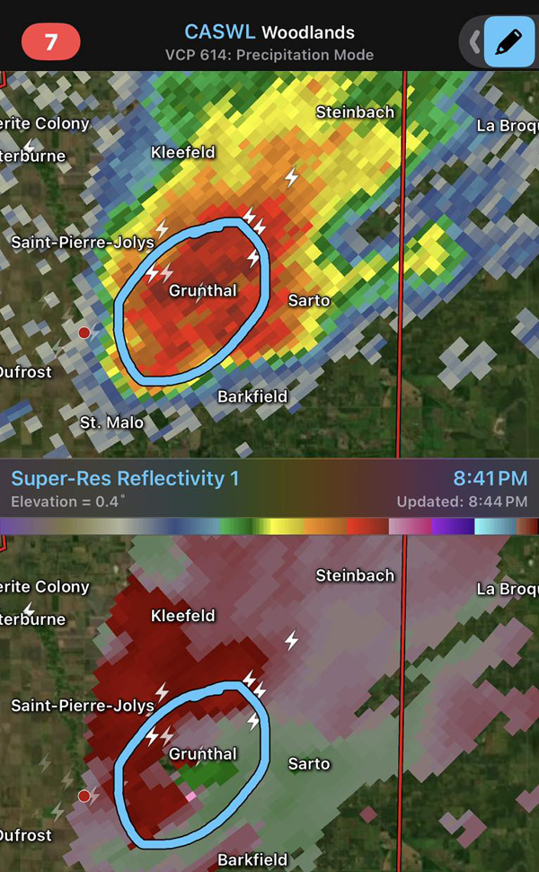
At around 8:45 pm Wednesday, Environment Canada issued a Tornado Warning.
The alert notification alarmed many residents of southeastern Manitoba as the statement said, “At 8:45 pm CDT, Environment Canada meteorologists are tracking a severe thunderstorm that is possibly producing a tornado. Damaging winds, large hail and locally intense rainfall are also possible.”
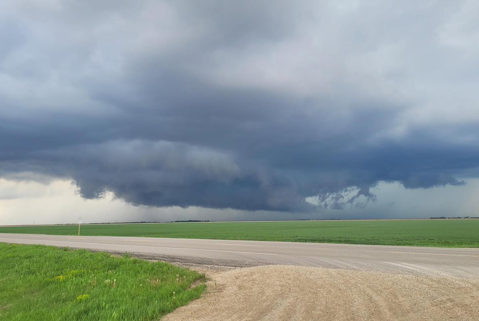
There were many social media posts of funnel sightings, with some residents sharing concerns about safety for their family members after alerts were posted to “seek shelter immediately. Take cover in a basement, interior room or sturdy shelter away from windows.”

Environment Canada is yet to confirm that the funnel clouds spotted by many residents of the southeast were tornadoes.
The severe weather system has moved into northern Ontario, with a 30% chance of showers today and a risk of an afternoon thunderstorm late this afternoon.
Residents of the southeast also noticed that ditches and drains along roads and highways are at high levels on Thursday.
Here are the rainfall amounts for Wednesday night:
Marchand 54mm
Rosa 53mm
Gardenton 46mm
St Pierre 45mm
Morris 45mm
Dominion City 41mm
Richer 38mm
Steinbach 38mm
Zhoda 24.8mm
25mm = 1 inch
Two-day totals, including Tuesday’s rainfall, show that many regions in the southeast have received more than 3 inches of rain.
Tuesday and Wednesday total rainfall amounts:
Dominion City 93mm
Rosa 86mm
Marchand 78mm
Gardenton 75mm
St Pierre 72mm
Richer 68mm
Steinbach 67mm
Zhoda 45mm
St Adolphe 43mm
25mm = 1 inch
]]>